Sea level rise will cause rivers to jump course, a phenomenon called avulsion, more often on deltas than in the past, research has found.
The same team has now discovered that a perfect storm of factors—including larger floods and finer sediment size—will enable these destructive events to occur farther and farther inland. The results, which appear in Geophysical Research Letters, warn of major disasters poised to hit many urban centers that historically never had to worry about these issues. The prior finding appears in PNAS.
On large, relatively flat rivers, avulsions tend to occur in the backwater region, explains
geomorphologist Vamsi Ganti of the University of California, Santa Barbara. “This is the zone over which the river flow feels the effect of the sea level.” This region begins at the river mouth and can extend relatively far inland. For instance, the Mississippi River’s backwater reach stretches 500 kilometers (311 miles) from the coast.
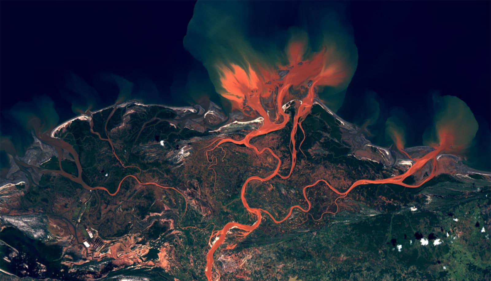
The team was looking through satellite and remote sensing data for historical avulsions and came across the unique deltas of Madagascar. The island has a host of short rivers that course down from the mountains carrying very fine sediment. This is due to the saprolitic soils—loose, soft soils made of silt and disintegrating rock—that dominate the country’s highlands. Exacerbated by rampant deforestation on the island, the exposed soils feed the island’s turbid, red rivers and make it one of the fastest eroding places on Earth, according to lead author Sam Brooke, a postdoctoral scholar in the geography department.
Using multiple satellite images taken since the late 1970s, Brooke created time series animations that communicate just how fast Madagascar’s river deltas are evolving. Using this data, he was able to obtain the rivers’ discharge rates as well as the amount of time the channels remained full during floods.
Combining the data with the satellite imagery led to a surprising conclusion. The avulsions weren’t occurring anywhere near the rivers’ backwater zones. “[Instead, they were] about 20 times [farther] upstream,” Brooke recalls, “way outside of where we’d expect them to be based on […models] using simple backwater scale.” The researchers realized they had to update their models of where avulsions occur on deltas.
River adjustment and flood duration
The team’s expanded theory boils down to a simple relationship. Two processes are at work in river channels—the duration of floods, and the time it takes for the river to adjust to changes. The relative timescales of these phenomena dictate where avulsions occur.
If floods are shorter than the time the river takes to adjust, then erosion and deposition are limited to the backwater zone. However, if floods last longer than it takes the river to adjust, erosion during floods can travel far upstream of the river mouth, which makes it possible for the river to avulse much farther inland.
Large flat rivers, like the Mississippi, change slowly, but steep rivers with lots of fine sediment can adjust quite quickly. “The whole channel can be resurfaced within the backwater zone in a given flood,” says Ganti, “and erosion can propagate much farther upstream.” This is the case for rivers like those in Madagascar, which are relatively steep and have a lot of fine sediment.
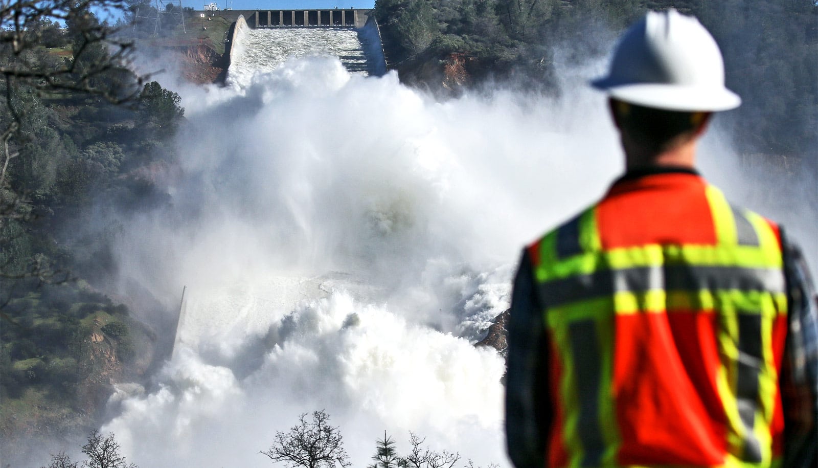
A river floods when it’s carrying enough water to overtop its banks. And for most of its length, a flooded waterway will do just that. But water level is constrained by sea level near the river’s mouth up through the backwater zone. So the increased volume of water during floods begins moving faster, increasing erosion, and scouring the river bed deeper.
This wave of erosion can then spread upstream as flood conditions continue, enabling the river to avulse far upstream from the backwater zone—much farther than anticipated.
Avulsions will move inland
“Climate models predict that extreme floods will occur more often in a warming world,” says Ganti. As a result, avulsions could begin moving even farther inland on rivers around the world.
But greenhouse gas emissions are not the only human activity affecting rivers. Sand and gravel are critical components in construction and infrastructure, and humans are now mining these resources on massive scales. Unfortunately, these make up the coarse fraction of alluvial sediment, which means that our activities are leading to finer sediment in many locations. Rivers can carry more of this fine-grained material, and the increased load reduces the amount of time it takes channels to change. Once again, this enables avulsions to occur farther upstream.
What’s more, sea level rise is pushing the backwater zone itself farther inland. These three factors combine to create the perfect recipe for major avulsions to occur ever farther inland on deltas, Ganti explains. This could lead to an increasing trend of homes, lives, and livelihoods lost due to extreme flooding, likely in locations that never had to deal with these hazards historically.
And according to the team’s previous paper these events will also become more frequent as the sea level rises.
“We should brace ourselves for avulsion as a serious flood hazard in the future,” Vamsi cautions.
River deltas have always been a critical resource for humanity, harnessed for agriculture, transportation and industry. Many of civilization’s largest cities have grown along the banks of the world’s great waterways. Their dynamism has always posed a challenge to society, but as rivers become less predictable and more volatile, researchers say, we will need to take more precautions to ensure our safety and wellbeing.
Source: UC Santa Barbara