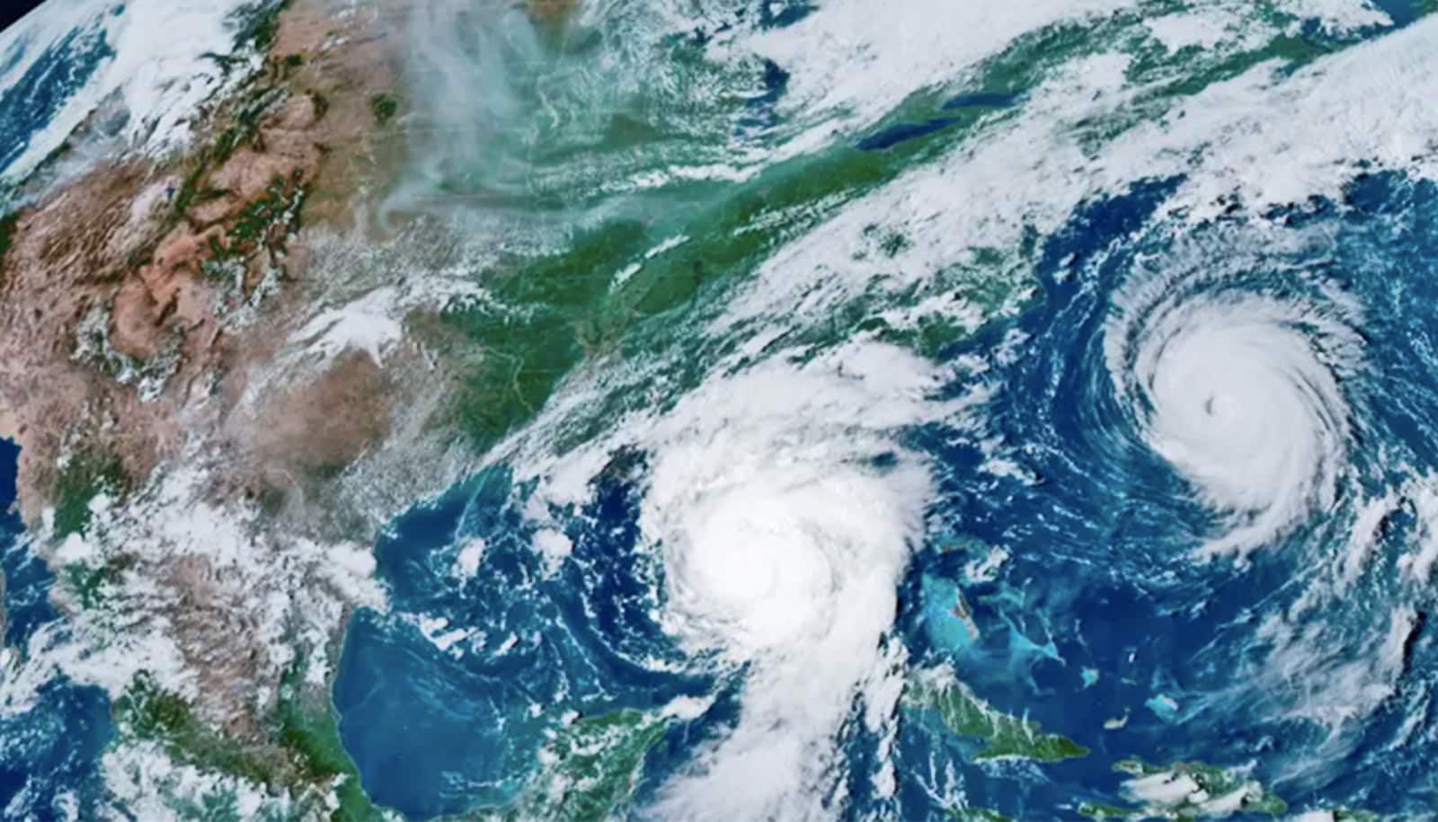
Experts have answers for you about how El Niño, which is characterized by warmer-than-average sea surface temperatures in the equatorial Pacific Ocean, could affect the upcoming Atlantic hurricane season.
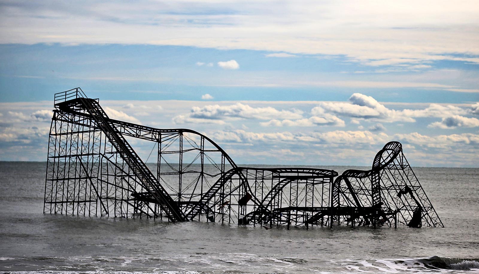
After hurricanes damaged the roof and caused extensive structural damage to his home, Miami resident Benjamin Thomas has always kept up with annual tropical storm season outlooks issued by meteorologists, always deciding to err on the side of caution and prepare for the worst, no matter what the forecasts call for.
This year, Thomas has been reading a lot about how the climate phenomenon known as El Niño could suppress tropical storm development in the Atlantic. “Anything that can help decrease the number of hurricanes would be a godsend,” he says.
Characterized by warmer-than-average sea surface temperatures in the central and eastern equatorial Pacific Ocean, El Niño events are known to increase upper-level vertical wind shear across the Atlantic, bringing stronger winds that tear developing storms apart. The latest outlook from the European Centre for Medium-Range Weather Forecasts projects an increased chance for a strong El Niño this year.
“Most of the computer climate models are predicting an El Niño for later this year,” says Emily Becker, a research associate professor in the atmospheric sciences department at the University of Miami Rosenstiel School of Marine, Atmospheric, and Earth Science.
“In addition to the models, another indicator we look for a few months ahead of time is the amount of warmer water underneath the surface of the Tropical Pacific, and right now, those temperatures are elevated.”
El Niño events occur every two to seven years and typically last from nine to 12 months. Its counterpart, La Niña, which means “little girl” in Spanish, is distinguished by cooler-than-normal temperatures in the Pacific. Both can influence weather patterns across the globe.
“Currently, there’s about an 80% chance that an El Niño will develop by fall, with a one-in-four chance that it will eventually become a strong event,” Becker says.
Though a strong El Niño, meaning “little boy” in Spanish, may result in suppressed Atlantic hurricane activity and wetter winter conditions in the Southeast, the phenomenon will spawn far different weather conditions in other parts of the country, Becker pointed out.
“In the Southwest, El Niño winters can be wetter and cooler, which would be good for the drought that’s developing there,” she says.
“More storms can impact the West Coast, which will sometimes lead to flooding and landslides. And the Pacific Northwest tends to be drier during an El Niño year. And with a stronger El Niño, we have more confidence that we will see those typical impacts.”
And for the Pacific, which experiences warmer-than-average ocean temperatures during an El Niño, an increase in tropical storm development would be likely, Becker says.
But to what extent El Niño will impact the approaching Atlantic hurricane season will depend on several of factors—chief among them, the timing of the climate pattern’s arrival and just how much Atlantic Ocean temperatures will heat up.
“If the onset of El Niño comes in a little late, then the effect on Atlantic wind shear would be minimal,” says Ben Kirtman, a professor of atmospheric sciences and dean of the Rosenstiel School.
“The second issue is temperatures in the Atlantic. Extremely warm Atlantic Ocean temperatures can offset the shear effect.”
Also in play: the timing of the Madden-Julian Oscillation, or MJO. An eastward moving disturbance of clouds, rainfall, winds, and pressure that traverses the planet in the tropics and returns to its initial starting point in 30 to 60 days, MJO can have a noticeable impact on hurricane seasons.
“If the timing of the enhanced wet phase of the MJO coincides with hurricane season, then we could expect more storm activity,” Kirtman explains.
But whatever factors influence the approaching Atlantic hurricane season the most, “it’s still too early to forecast just how far below average the season might be,” says Andy Hazelton, an associate scientist at the Cooperative Institute for Marine and Atmospheric Studies, a National Oceanic and Atmospheric Administration agency based at the Rosenstiel School that Kirtman directs.
“It will depend on what Atlantic sea surface temperatures are like, and right now they’re average or a little below.”
While artificial intelligence and machine learning are being increasingly employed to enhance weather and climate forecasting, their use in predicting El Niño events is still—at least for now—somewhat limited, according to Becker.
“Those computer models need a huge amount of data to train, and we’ve had only about 75 years of ENSO events,” says Becker, referring to the climate phenomenon known as El Niño-Southern Oscillation, a natural two- to seven-year cycle of Pacific Ocean temperature fluctuations switching between warm (El Niño), cold (La Niña), and neutral phases.
“And in those 75 years,” Becker says, “there’s been about 25 El Niño and 25 La Niña events. So, it’s hard to get enough data to train those machine learning models.”
As AI models evolve, they may eventually catch up in their ability to forecast El Niño and La Niña events. For now, though, researchers mostly rely on dynamical models of observed conditions, employing “all the math and physics we’ve discovered in the last 150 years to calculate potential outcomes,” Becker explained.
The North American Multi-Model Ensemble, or NMME, has consistently produced remarkably accurate El Niño and La Niña forecasts ever since Kirtman developed the seasonal prediction system 15 years ago. Its strength lies in the fact that it combines information from several different climate models into a multi-model ensemble, producing better forecasts overall than those from a single model. It posts global forecasts early each month and informs NOAA’s official seasonal outlooks.
In the weeks ahead, researchers will be closely monitoring Pacific Ocean temperatures to help gauge just how strong an El Niño will develop.
“No matter what,” says Miami resident Thomas, “I’ll be ready.”
Source: University of Miami