Charles Darwin created a “beautiful” theory of how atolls form. But, say researchers, he lacked a key piece for information.
Marine geologist and oceanographer André Droxler knows Darwin’s theory about atolls is incorrect. But Droxler, who’s studied coral reefs for more than 40 years, understands why Darwin’s model persists in textbooks, university lecture halls, natural science museums, and Wikipedia entries.
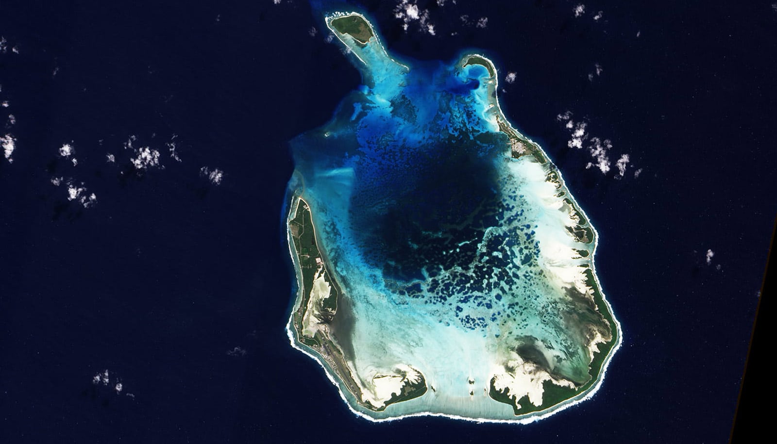
“It’s amazing, when you compare satellite images of reefs today versus his map. It’s almost the same. It’s unbelievably accurate.”
“It’s so beautiful, so simple and pleasing that everybody still teaches it,” says Droxler, who recently retired from Rice University. “Every introductory book you can find in earth science and marine science still has Darwin’s model. If they teach one thing about reefs or carbonates in marine science 101, they teach that model.”
Droxler, a professor of earth, environmental, and planetary sciences at Rice for 33 years, is hoping to set the record straight with a paper about the origins of atolls. Droxler and longtime collaborator Stéphan Jorry, a marine geologist and oceanographer at the French Research Institute for Exploration of the Sea, report their work in the Annual Review of Marine Science.
Don’t crash the Beagle
Darwin’s theory about the formation of atolls was published in 1842, six years after his legendary voyage aboard the British survey ship HMS Beagle. A geologist by training, Darwin was keenly interested in the rocks and landforms he encountered in his five years aboard the Beagle. The ship’s primary mission was surveying coastlines and hazards to navigation, and the ship’s orders included collecting detailed observations of the tides and ocean depths around a coral atoll.
“They spent a lot of time mapping reefs because they were such hazards to shipping,” Droxler says of the Royal Navy. Atolls were particularly interesting and dangerous. Some were topped with low-lying islands but many were jagged rings of coral-topped rock that sat just below the water’s surface, ready to rip the bottom out of unwary passing ships. “They come out of the abyssal plain of the ocean to almost no depth,” Droxler says. “So they needed to know exactly where they were located.”
The Beagle, like every Royal Navy vessel, carried charts with the marked location of every known reef, and Darwin put these to use in his 1842 paper.

Darwin’s amazingly accurate maps
“He published a beautiful map that compiled all the known reefs on Earth,” Droxler says. “It’s amazing, when you compare satellite images of reefs today versus his map. It’s almost the same. It’s unbelievably accurate.”
But unlike navy maps that simply marked reefs as hazards to navigation, Darwin systematically classified each into one of three categories. Those attached to land, he called fringing reefs. Those detached from land and separated by a lagoon were barrier reefs. The third category was atolls, ring reefs that enclosed a central lagoon but no land.
At the time, geologists believed continents were steadily rising out of the Earth and oceans were steadily sinking. Darwin noticed that both fringing and barrier reefs tended to surround volcanic islands, and he reasoned reefs initially formed on the fringe of volcanic islands. When the volcano died and slowly sank back into the ocean, the reef remained, first becoming a separated barrier reef and eventually, after the volcano sank entirely, an atoll.
Droxler says he’s awed by Darwin’s ability to synthesize all that was known about reefs in his day and come up with such a simple, comprehensive, and compelling theoretical model. And yet.
“Cyclic changes in sea level drive atoll formation,” Droxler says. “Darwin had no concept that sea level could go up and down, because glaciation didn’t become common knowledge until the 1860s.”
Swings in sea level
Droxler says the simplicity of Darwin’s classification system and theory could play a role in its continued appeal. A more accurate description of atoll formation has been around since the 1930s, but it is considerably more complicated and much of the evidence to support it is more recent, coming in the past 40 years from dozens of scientific and oil industry drilling expeditions as well as from the compiled record of Earth’s climate and sea level history.
Today’s atolls formed in the past 500,000 years, Droxler says, driven by five wild swings in sea level that occurred every 100,000 years. In each cycle, sea level rose and fell by 120 meters (about 394 feet) or more. But to fully appreciate how changing sea level created atolls, it helps to start much earlier, Droxler says.
“The Earth’s climate has changed quite dramatically in the last 5 million years,” he says. “From about 5 million years ago to 2.5 million years ago, we had a rather warm climate that did not change very much, and sea level remained relatively constant. At that time, the Earth was producing flat-topped banks where today we have atolls.”
Sea level rose steadily but slowly, and the flat-topped banks that would give birth to atolls were created by countless generations of corals and other sea creatures that lived and died, adding their skeletons to the mineralized floor of the shallow, flat-topped marine ecosystem. The flat-top banks grew steadily, keeping pace with sea level until the warm period ended about 2.5 million years ago.
“The climate began to fluctuate into cycles,” Droxler says. “There were alternate periods of warm and cold, but overall, the trend was that the Earth’s climate got colder and colder and colder, interrupted by short warm swings.”
How atolls form
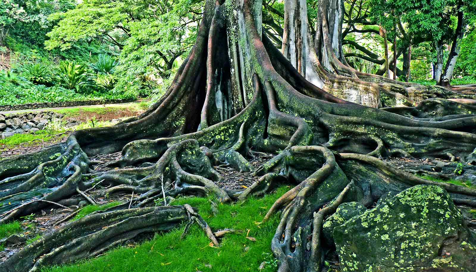
Throughout this period, ice caps were thickening. As ice accumulated, sea level fell, exposing the tops of the flat carbonate banks, which rose out of the ocean like bleached stone mesas. When rain fell atop the exposed banks, it slowly dissolved the carbonate, and standing water sped up the process. Puddles and ponds gradually carved bowl-like depressions. And over 2 million years, this process turned white mesas into ring-like towers with hollowed-out central depressions.
“Ice volume on Earth reached its initial maximum around 500,000-600,000 years ago, when a mile of ice covered Chicago, and New York was at the southern edge of a massive ice sheet on North America, comparable to modern Antarctica,” Droxler says. “There was so much ice in North America, Scotland, Scandinavia, and Siberia that sea level was reaching 120 meters to 130 meters below what it is today.”
The five dramatic swings in sea level that occurred in the past half-million years were driven by Earth’s ability to form large northern ice sheets, and by the sensitivity of those ice sheets to slight climatic changes, like fluctuations in the amount of sunlight landing in the far Northern Hemisphere due to slight changes in the planet’s orbit and tilt.
“Because these big ice sheets formed in North America, not on the pole, but centered in relatively low latitude about 65 degrees north, they accumulated huge ice volumes that lowered sea level by more than 120 meters,” he says. “But also, they were able to melt very quickly. And so we observe, now, these cyclic high-amplitude swings of sea level. And the first big swing was about at 450,000 years ago, when it went from minus-135 meters to plus-10 meters of what we have today.”
During each swing, the hollowed out flat-topped banks were resubmerged during warm periods, when sea level rose near its highest level. During those periods, as today, coral recolonized the highest parts of the eroded banks, in particular along their raised outer rims.
“Now you’re adding carbonate on to their raised rim, and you’re creating the modern atolls,” Droxler says. “But this period of high sea level doesn’t last for more than 10,000-12,000 years, and it goes down again. So now you are adding some reef on the rim, but then dissolving the lagoon again when sea level retreats. So you are enhancing the morphology even more with each cycle now, growing on the margin and dissolving in the middle.”
Droxler’s and Jorry’s in-depth study contains dozens of illustrations, including some comparisons of Darwin’s original drawings with contemporary maps and satellite imagery. And the paper draws on decades of marine geological data compiled from dozens of expeditions, including recent datasets acquired by both coauthors in the Indian Ocean.
Funding for the work came from the National Science Foundation, Royal Dutch Shell, Total, the Environmental Protection Agency of the Maldives, the University of South Florida, and the Passive Margins Exploration Laboratories research program of IFREMER, the French National Center for Scientific Research, the University of Rennes, the University of Western Brittany, Pierre and Marie Curie University, and the French Institute of Petroleum.
Source: Rice University